Components
OCR Engine
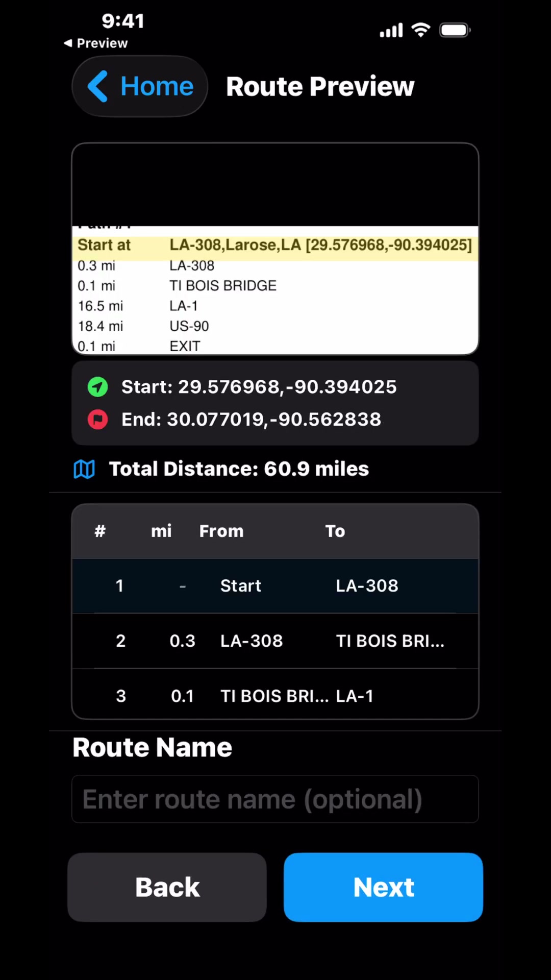
Load permits from photos, PDFs, or image files. Instructions extracted.
Road Database
Proprietary database of intersections. Continuously expanding coverage.
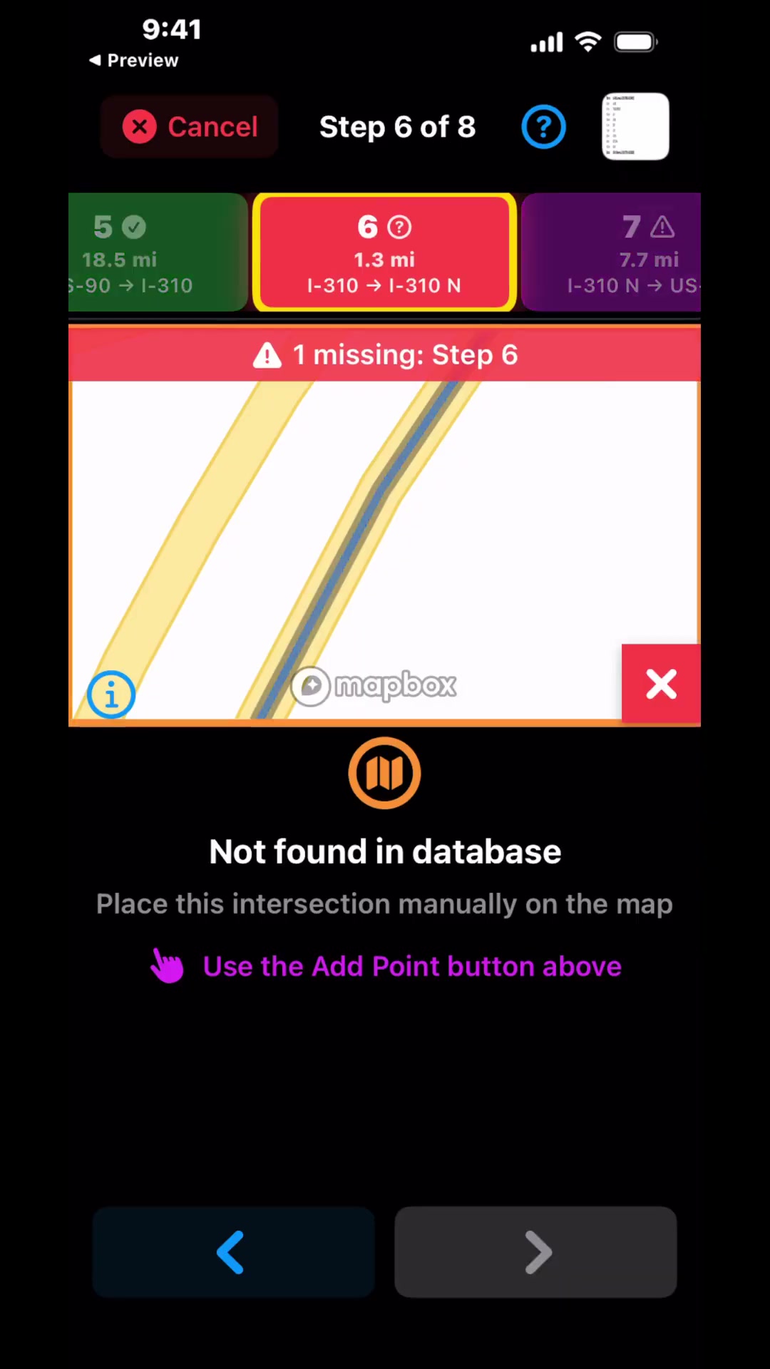
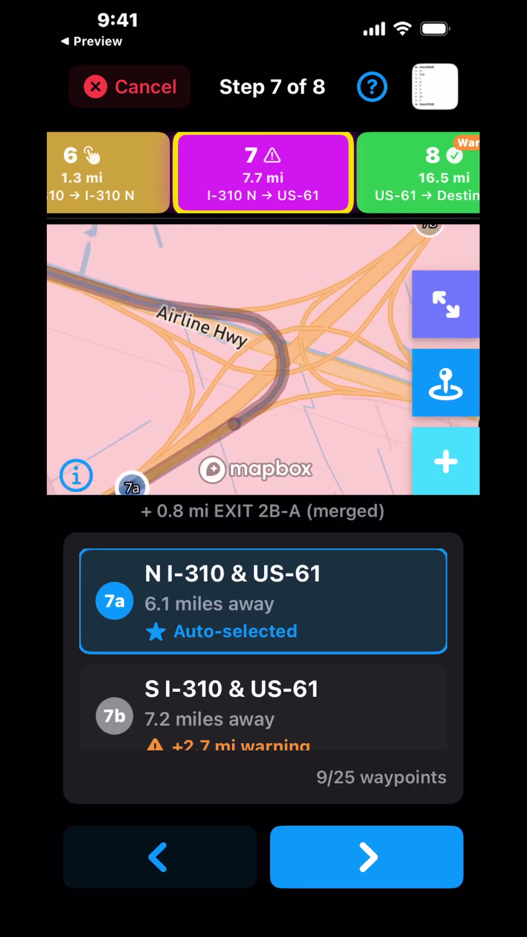
Route Verification
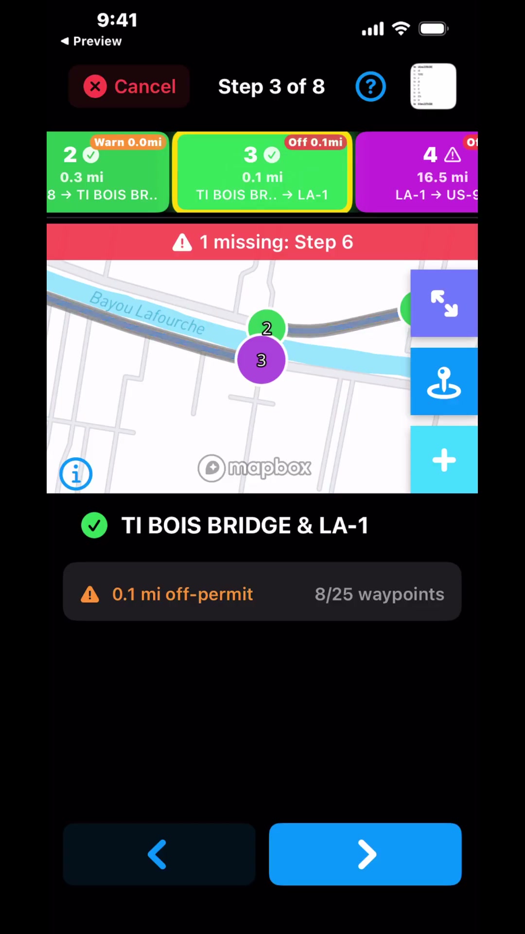
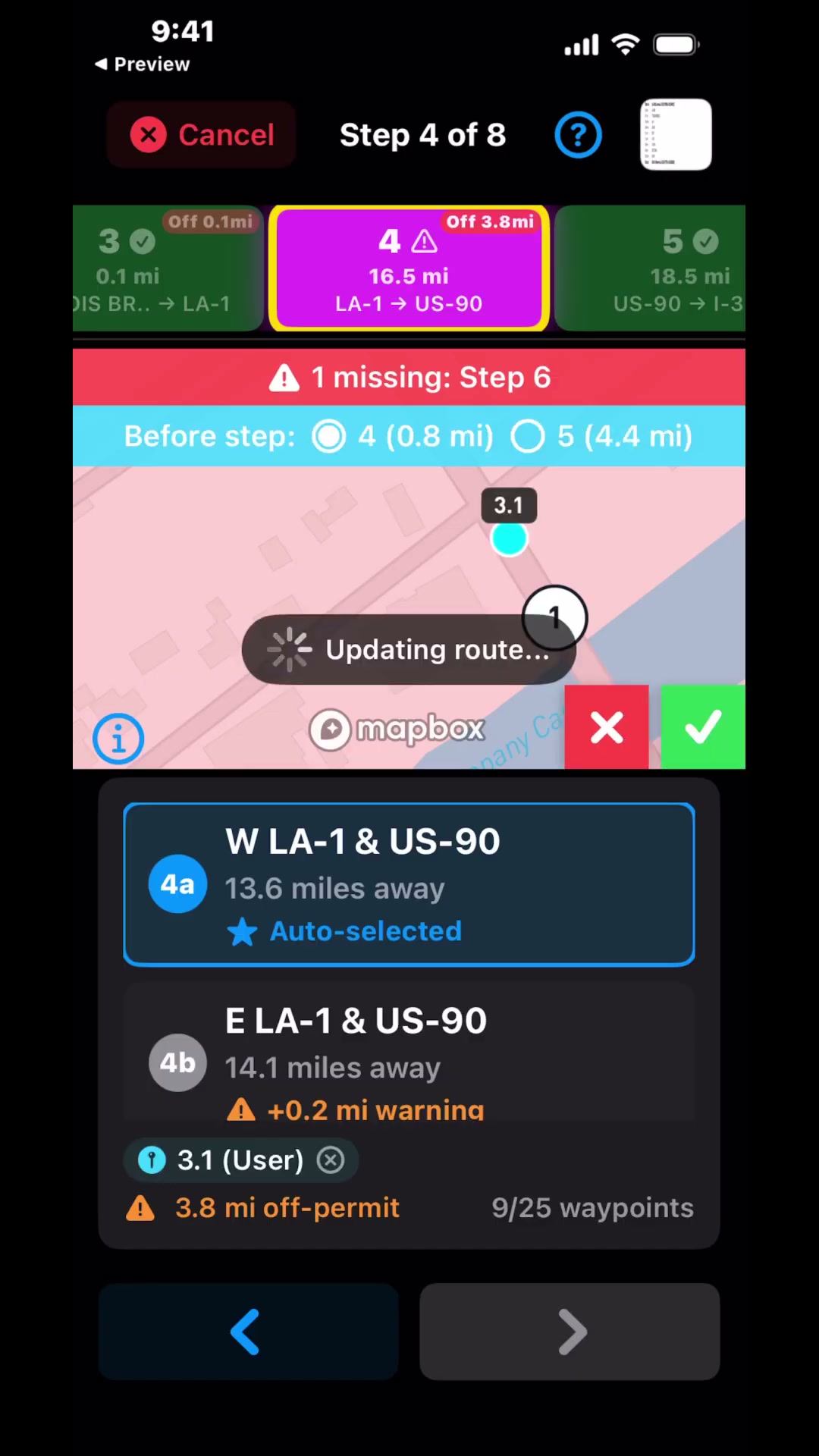
Intersections matched against our proprietary database. Pick from options or place missing waypoints on the map. Easy to fix problems yourself.
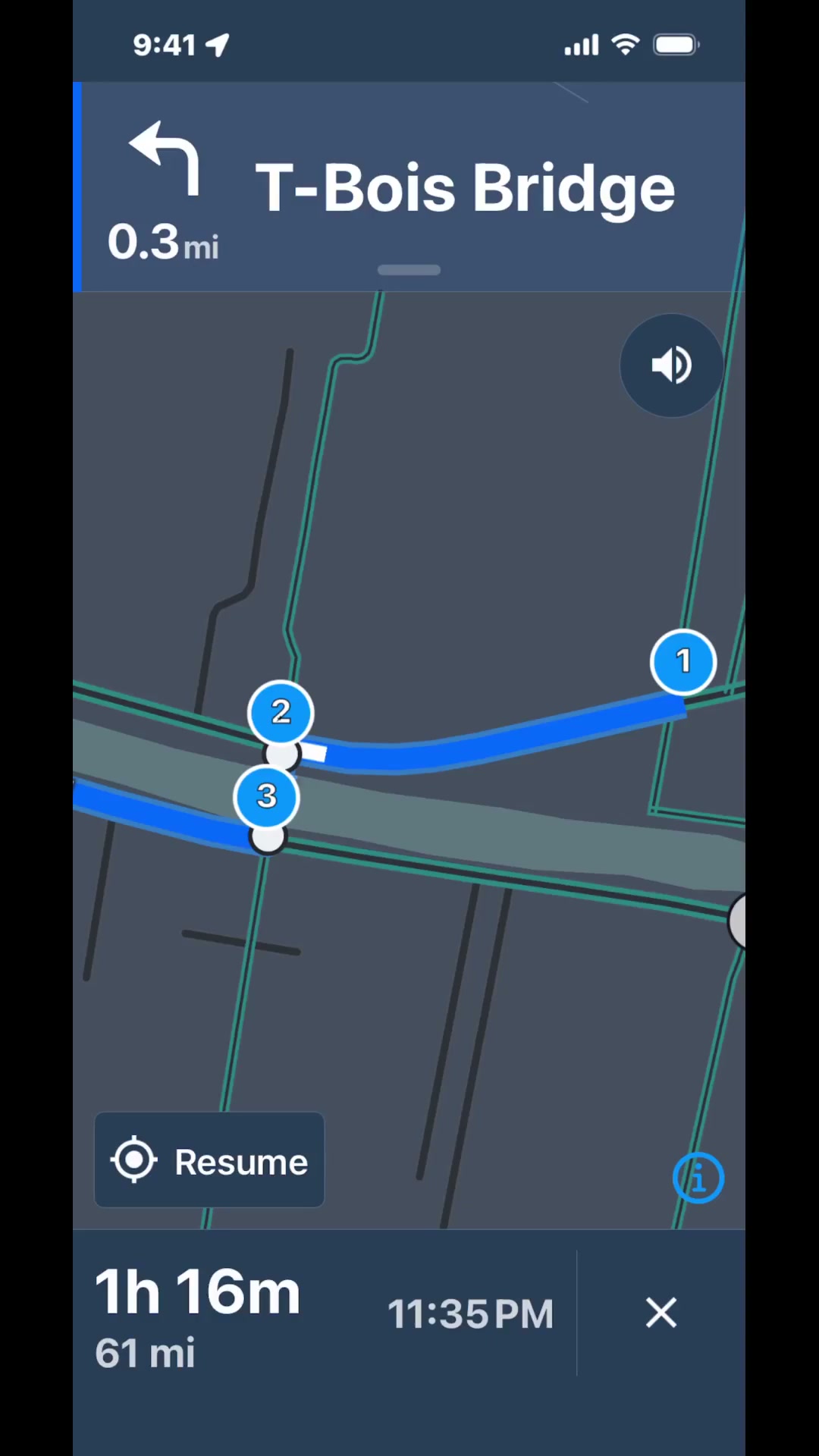
Truck Navigation
Turn-by-turn GPS follows the permit. Set anchor points to lock the route to specific roads.
Data Pipeline
Input
Route Card
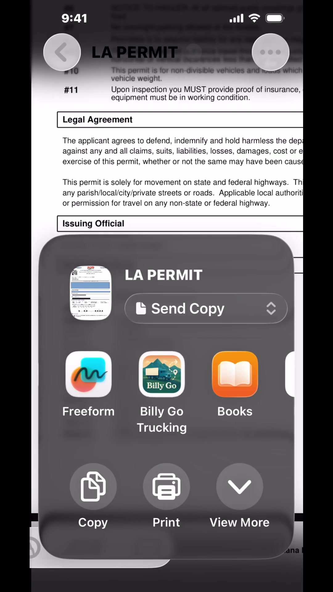
Photo, image, or PDF of a state-issued permit with driving instructions
→Extract
OCR
Instructions extracted from the permit
→Resolve
Database Lookup
Each intersection queried against our proprietary database. Best matches surfaced
→Verify
Driver Review
Select, place, and anchor at any intersection
→Output
GPS Route
Route ready for turn-by-turn navigation on permitted roads
Interface